|
| *****SWAAG_ID***** | 871 |
| Date Entered | 28/03/2015 |
| Updated on | 03/04/2015 |
| Recorded by | Tim Laurie |
| Category | Ring Cairns |
| Record Type | Archaeology |
| Site Access | Public Access Land |
| Record Date | 05/03/2015 |
| Location | Bolton West Park. Beldon Beck. East side. |
| Civil Parish | Castle Bolton with E and W Bol |
| Brit. National Grid | SE 00806 92112 |
| Altitude | 328m |
| Geology | Glacial till over limestone. |
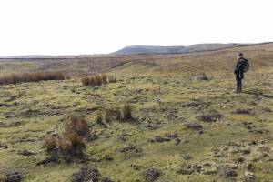
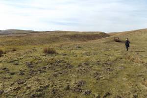
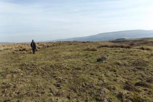
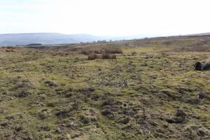
| Record Name | Ring cairn on east side of Beldon Beck. West Bolton Park. |
| Record Description | Ring cairn defined by a continuous, low, circular 1.5m wide turf covered stone bank. No visible entrance. Approximately 12.5m diameter overall. Probably reduced by quarrying for stone.
Indications of a central cairn.
This ring cairn is RC1 on the published Location Map (Laurie, 2003. Figure 61: Carperby Moor, Prehistoric Sites). |
| Dimensions | Approximately 12.5 m diameter overall. |
| Additional Notes | The siting of this slight ring bank at a vantage view point,the absence of any visible entrance and the small central cairn feature is characteristic of a ring cairn. In contrast,
a second stone ring bank of similar dimensions which is situated at the base of a fairly steep slope some 100m to the NE. This ring bank has an entrance in the SE quadrant and is best interpreted as a small round house associated with the field system on Bolton West Park to be recorded as a later SWAAG Record. |
| Image 1 ID | 6157 Click image to enlarge |
| Image 1 Description | Beldon Beck Ring Cairn view westward. |  |
| Image 2 ID | 6158 Click image to enlarge |
| Image 2 Description | Beldon Beck Ring Cairn view northward. |  |
| Image 3 ID | 6159 Click image to enlarge |
| Image 3 Description | Beldon Beck Ring Cairn view eastward |  |
| Image 4 ID | 6160 Click image to enlarge |
| Image 4 Description | Beldon Beck Ring Cairn view southward |  |


